Tjenester
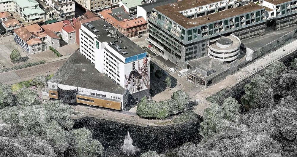
A point cloud is a highly detailed 3D representation of real-world environments made up of millions — sometimes billions — of individual measurement points. Each point contains precise spatial coordinates (X, Y, and Z), and often additional information such as intensity, color, or classification. At Field we deliver end-to-end point cloud solutions — from data acquisition to advanced analysis and deliverables.

Punktskyer
Point clouds are typically generated using advanced technologies such as:
When combined, these individual points create an accurate, measurable digital replica of terrain, buildings, infrastructure, vegetation, and other physical features.
Field delivers Point cloud services that supports a wide range of industries and applications, including:
Because the data is measurable and spatially accurate, it becomes a powerful foundation for GIS, CAD, BIM, and digital twin workflows.
At Field, we leverage artificial intelligence to unlock the full potential of point cloud data. AI algorithms can automate and enhance tasks that are traditionally time-consuming, such as:
Classification - Automatically identifying ground, buildings, vegetation, roads, and other features
Object Detection - Detecting and mapping poles, power lines, vehicles, or construction equipment
Change Detection - Comparing point clouds over time to track construction progress, erosion, or land-use changes
Noise Removal & Data Cleaning - Quickly filtering out errors and irrelevant points
Predictive Modeling - Identifying patterns or potential risks in infrastructure or natural environments
Our team of geospatial specialists combines years of experience with cutting-edge AI-powered intelligence to deliver highly accurate point clouds and insights.
Get in touch if you would like more information.
Luftbåren datafangst, RGB-punktsky, laserskanning.
Field tilbyr et bredt spekter av geospatiale kartleggings- og datatjenester, som kartleggingstjenester for byer og korridorer, fjernmålingsbasert skogregistrering og lokasjonsbaserte tjenester. Vi lever i en digital verden, der digitale modeller av fysiske eiendeler er standarden. Design, konstruksjon og vedlikehold gjøres i 3D, noe som sparer kostnader og øker effektiviteten. Vi har omfattende erfaring med å behandle geospatiale data til 3D-modeller av byer, infrastruktur, bygninger, terreng og havbunn. Utforsk mer Field Kartleggings- og modelleringstjenester nedenfor.
Bli med oss og hjelp med å fange opp og transformere nøyaktige geospatiale data til verdifull innsikt og digitale tvillinger.