Tjenester
Laserskanning er en effektiv metode for å dokumentere og digitalisere en bygning, vei eller terreng med høy nøyaktighet. Vi tilbyr laserskanning fra mange forskjellige plattformer og er eksperter på å finne den rette løsningen for kundenes behov, vanligvis ved å kombinere forskjellige skannemetoder.

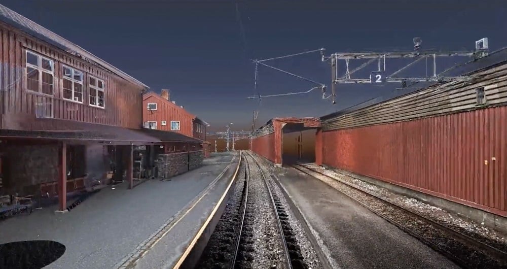
3D-laserskanning er en av de mest nøyaktige skannemetodene vi bruker.
Laserskanneren er statisk og flyttes manuelt fra skanneposisjon til skanneposisjon, noe som gir en svært detaljert punktsky med RGB-farger og 360 panoramabilder.
Punktskyer med denne nøyaktigheten og detaljeringen er ideelle for å dokumentere en eksisterende situasjon.
Denne metoden kan brukes på mange forskjellige måter, inkludert:

What is 3D scanning?
3D scanning uses various types of sensors to reliably measure and record objects in three-dimensional space. The resulting point cloud of data provides accurate point clouds of interior environments, buildings, or structures. This is useful in architecture, engineering, and other fields for accurate documentation and analysis of indoor environments.
What accuracy do you need?
The accuracy you order has a lot to do with the price. In general, the higher the accuracy you need, the more it costs. Consider what you will use the result for. And choose the accuracy according to your needs. We are happy to help you make the right choice!
Revit, ArchiCAD, and IFC models?
All three are BIM (Building Information Models). Which one do you need? Check who will be working with the model and what they prefer to work in. An architect will often prefer an ArchiCAD model. Others will prefer a Revit model. And some will only want a 2D drawing. Be sure before you order. You can save a lot of time and money here. We can also help you figure out what you need!
Do you offer Google Street View?
Are you tired of traveling to the project to take measurements and check things that were forgotten during the inspection? We can scan and create a Google Street View of your project so you can take measurements and even operate the building from your PC, mobile phone, or tablet.
What does LOD mean?
In 3D scanning, LOD refers to different levels of detail that can be selected based on the needs and purpose of the model. Lower LODs can be used to represent general shapes and contours, while higher LODs provide more detailed information, including smaller details and textures.
How does 3D scanning improve quality control?
A 3D scan is excellent for checking that what has actually been built is in accordance with the drawings. We use 3D scans and compare them with the BIM model. This allows us to see what is within tolerances and what is outside them.
3D-laserskanningsmodell av jernbanenettet
Landmåling spiller en kritisk rolle i planleggings- og utførelsesfasen for de fleste infrastruktur- og byggeprosjekter over hele verden. Landmåling sikrer nøyaktigheten mellom digitale modeller og den fysiske verden. Landmålingsteknikken bestemmer den nøyaktige geografiske tredimensjonale posisjonen til punkter og avstandene og vinklene mellom dem. Teamet vårt har lang erfaring med å levere landmålingstjenester for myndigheter, bedrifter og privatpersoner, hovedsakelig i hele Norge, men også i Sverige og Finland. Utforsk mer Field Landmålingstjenester nedenfor.
Bli med oss og hjelp med å fange opp og transformere nøyaktige geospatiale data til verdifull innsikt og digitale tvillinger.